Original: $13.27
-70%$13.27
$3.98The Story
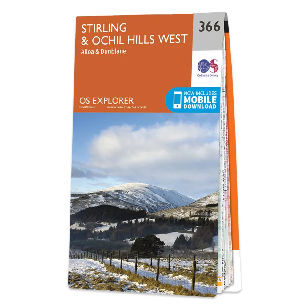
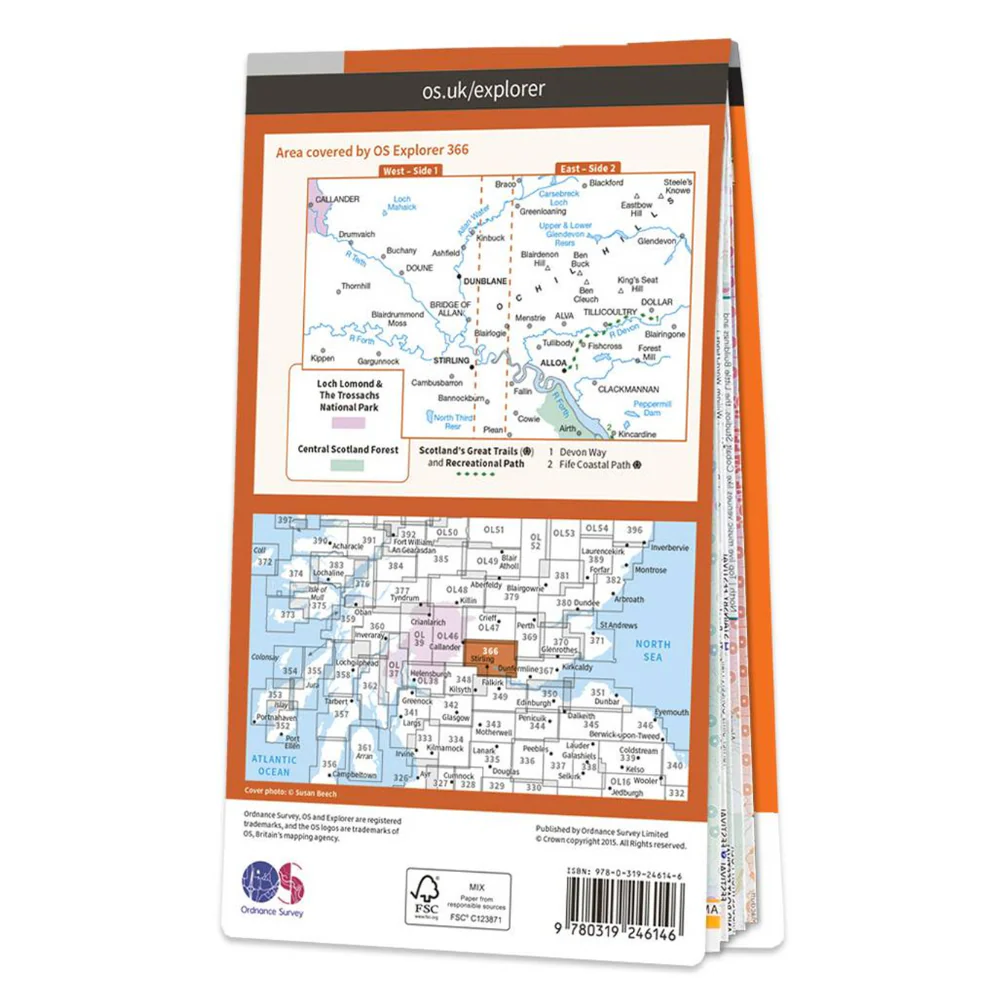
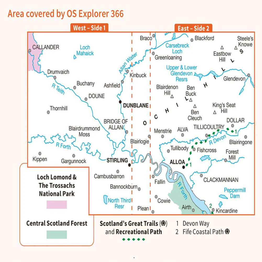
The essential map for outdoor activities in Stirling & Ochil Hills West. The OS Explorer Map is the Ordnance Survey’s most detailed folding map and is recommended for anyone enjoying outdoor activities, including walking, horse riding and off-road cycling. Map sheet number 366 covers Stirling, Alloa and Ochil Hills West. Highlights include River Forth, Allan Water and Upper and Lower Glendevon Reservoirs. Also includes Dunblane, Callander and Clackmannan. This map now comes with a digital version which you can download to your smartphone or tablet.
Providing complete GB coverage, the OS Explorer map series details information essential in the great outdoors, including youth hostels, pubs and visitor information. Rights of way, fences, permissive paths and bridleways are clearly shown, ensuring you have the best information to get the most out of your time in the countryside.
Features:
- Devon Way
- 1:25 000 scale (4 cm to 1 km – 2.5 inches to 1 mile)
- This map comes with a digital version, which you can download to your smartphone or tablet.
Go to OS.uk/redeem for more details (terms and conditions apply).
Scratch off the panel on the inside cover of the map to reveal a code, you are then just three easy steps away from downloading your digital map.
If the scratch panel has already been scratched off or if you have any problems downloading your map, please call the OS Customer Service Centre on 03456 050505.
Details & Craftsmanship
Every detail has been carefully considered to bring you the perfect product.
Details & Craftsmanship
Every detail has been carefully considered to bring you the perfect product.
Details & Craftsmanship
Every detail has been carefully considered to bring you the perfect product.

Details & Craftsmanship
Every detail has been carefully considered to bring you the perfect product.
Description
The essential map for outdoor activities in Stirling & Ochil Hills West. The OS Explorer Map is the Ordnance Survey’s most detailed folding map and is recommended for anyone enjoying outdoor activities, including walking, horse riding and off-road cycling. Map sheet number 366 covers Stirling, Alloa and Ochil Hills West. Highlights include River Forth, Allan Water and Upper and Lower Glendevon Reservoirs. Also includes Dunblane, Callander and Clackmannan. This map now comes with a digital version which you can download to your smartphone or tablet.
Providing complete GB coverage, the OS Explorer map series details information essential in the great outdoors, including youth hostels, pubs and visitor information. Rights of way, fences, permissive paths and bridleways are clearly shown, ensuring you have the best information to get the most out of your time in the countryside.
Features:
- Devon Way
- 1:25 000 scale (4 cm to 1 km – 2.5 inches to 1 mile)
- This map comes with a digital version, which you can download to your smartphone or tablet.
Go to OS.uk/redeem for more details (terms and conditions apply).
Scratch off the panel on the inside cover of the map to reveal a code, you are then just three easy steps away from downloading your digital map.
If the scratch panel has already been scratched off or if you have any problems downloading your map, please call the OS Customer Service Centre on 03456 050505.